Sanasto (englanti)
Some of the interface text in Estonian and Finnish is machine-translated
| Termi englanti | Termi venäjäksi | Termi viron kielellä | Termi suomeksi | Termin merkitys | Valokuva |
|---|---|---|---|---|---|
| Rhytmite | Ритм, ритмит | Vahelduv kihistumine | Rytmiitti, vuorokerroksellinen kerrostuma | Сonsists of layers of sediment or sedimentary rock which are laid down with an obvious periodicity and regularity. They may be created by annual processes such as seasonally varying deposits reflecting variations in the runoff cycle, by shorter term processes such as tides, or by longer term processes such as periodic floods. Rhythmites serve a significant role in unraveling prehistoric events, providing insights into sea level change, glaciation change, and earth's orbital variations which serve to answer questions about climate change. (Wikipedia) |
|
| Ribbed moraines | Ребристая морена | - | Ribbed–moreeni, Rogen-moreeni, Juomumoreeni | Group of irregularly sub parallel, locally branching, generally smoothly rounded and arcuate ridges that are convex in the downstream direction of a glacier but that curve upstream adjacent to eskers. They are most common in the continental ice sheets and are abundant in the Arctic. |
|
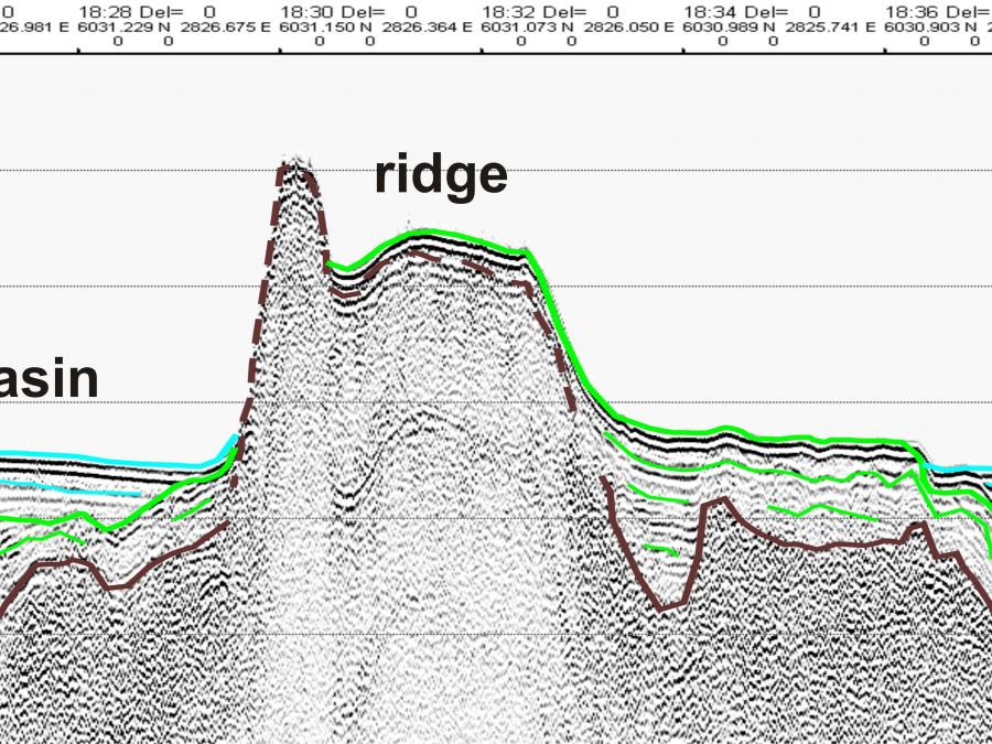
| Ridge | Гряда, хребет | Seljak | Harjanne | (1) Long, narrow elevation with steep sides; (2) long, narrow elevation often separatingocean basins; (3) linked major mid-oceanic mountain systems of global extent. |

|
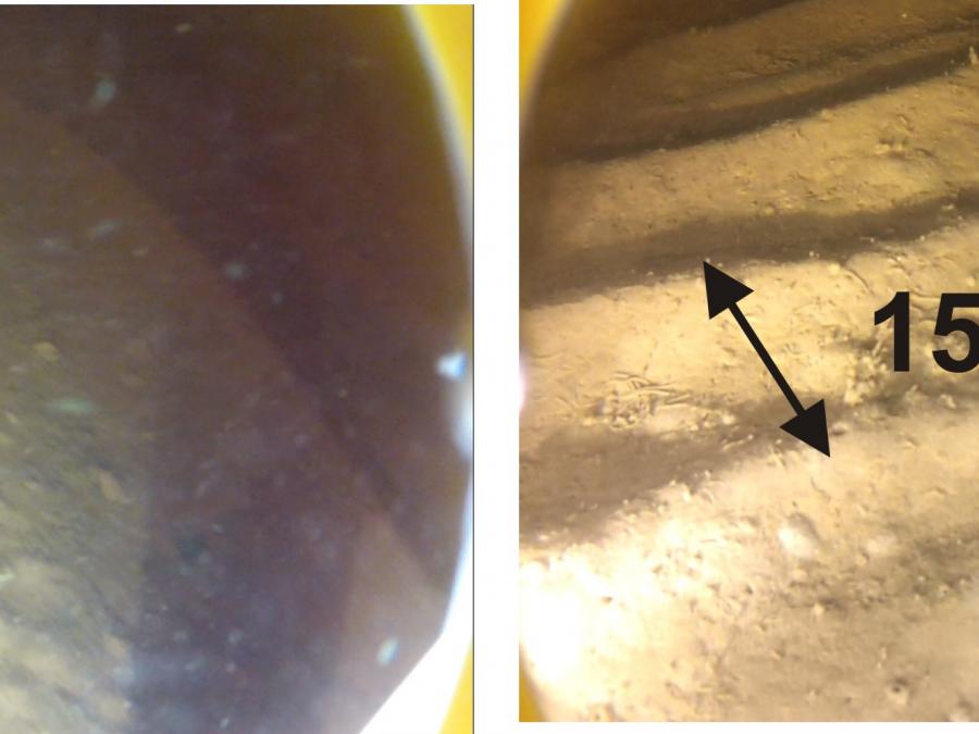
| Ripples | Рифели, знаки ряби | Vired | Aallonmerkki, Kare, Väre (Pienempi kuin dyyni tai Megaripple) | (ripple marks) lower-flow regime sedimentary bedforms , less than 0.6 m in wavelength and less than around 10 cm in height. Ripple marks are asymmetrical in profile, with a gentle up-current stoss slope and a steeper down-current lee slope at the angle of repose of the sediment. Wave-formed ripple marks have a symmetrical, almost sinusoidal profile. Ripple crestlines may be either linear (two dimensional) or nonlinear (three dimensional) in plan view. Typical flow velocity for ripples generating is about 25-60 cm/sec. |

|
| ROC | ROC | ROC | ROC | Remotely operated camera. |
|
| Rogen moraine | См. Ребристая морена | - | Rogen-moreeni | See Ribbed moraine. |
|
| Roughness | Расчеленность (рельефа) | - | Epätasaisuus, Karkeus, Rosoisuus | Measure of variation in depth (bed elevation) of the seabed relative to a specified length scale; in GIS, the largest intercell difference in bed elevation between a central grid cell and its surrounding cells (contrast with Topographic Position Index). |
|
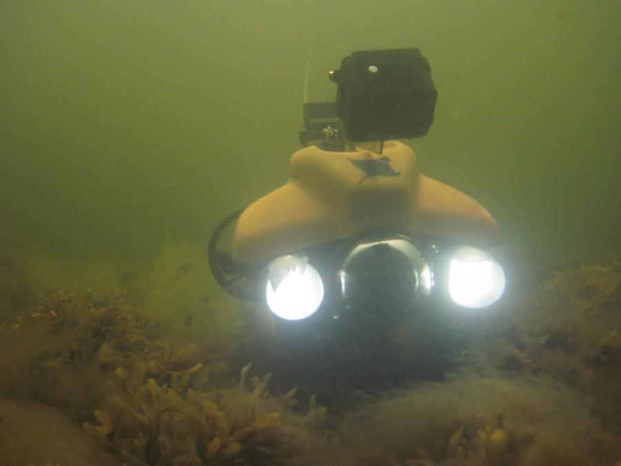
| ROV | Автоматический подводный аппарат (АПА), управляемый дистанционно | ROV | ROV | Remotely operated vehicle which is used for underwater filming of, e.g., habitats. |

|
| Rugosity | Шероховатость, неровность | Konarlikkus | Rugositeetti | In GIS, the ratio of the surface area to the planar area across the neighborhood of acentral grid point. See also Roughness. |
|
| Salinity | Соленость | Soolsus | Suolaisuus | Is the saltiness or dissolved salt content (such as sodium chloride, magnesium and calcium sulfates, and bicarbonates) of a body of water or in soil. In oceanography, it has been traditional to express salinity as permille (parts per thousand) (‰), which is approximately grams of salt per kilogram of solution. Other disciplines use chemical analyses of solutions, and thus salinity is frequently reported in mg/L or ppm (parts per million). Prior to 1978, salinity or halinity was expressed as Cl ‰, usually based on comparison with IAPSO Standard Seawater ("Copenhagen water"), a natural sea water distributed to serve as a world standard. In 1978, oceanographers redefined salinity in the Practical Salinity Scale (PSS) as the conductivity ratio of a sea water sample to a standard KCl solution. Although PSS is a dimensionless quantity, its "unit" is usually called PSU. It is not the case that a salinity of 35 exactly equals 35 grams of salt per liter of solution. Independently of an approach salinity is the sum weight of many different elements within a given volume of water. Salinity is an ecological factor of considerable importance, especially in estuarine types of water bodies, influencing all processes and all organisms (poikiloosmotic first of all) that live there. Effect of salinity on living organisms occurs via osmotic pressure and ionic composition of dissolved inorganic salts. In thalassic waters (including Baltic Sea and its estuaries) the major anion is Cl-. Inland waters represent is strong variability in ionic composition of dissolved salts, however, bivalent anions normally sufficiently contribute ionic composition of inland waters. |
